
We provide Civilian and Government clients with training and solutions to integrate and utilize our UAS / drone acquired imagery into their GIS, planning or situational awareness software.
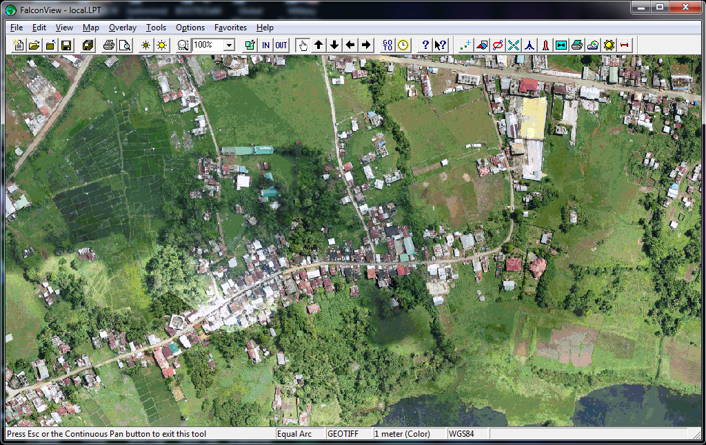
UAS acquired maps integrated in PFPS/FalconView. A commonly used mapping system used by various Armed Forces around the world.
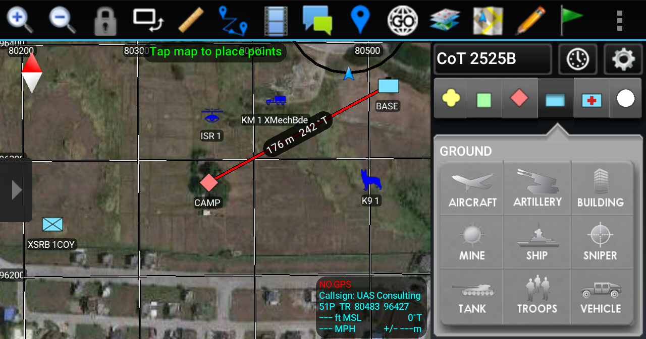
Situational Awareness (SA) mobile software imagery integration.
Our UAS/UAV imagery is optimized to be used on GIS and specialized defense software for ease of use and rapid dissemination to end-users. Especially in areas of operations without connectivity where software like Google Earth* cannot be used or is required during software startup.
We provide integration services for the following software:
- ArcGIS
- FalconView
- Quantum GIS (QGIS)
- Team Awareness Kit
- TIGR
- TerraExplorer
- XPlan
- … and more!
UAS Consulting has almost a decade of Imagery Intelligence (IMINT) and Geospatial Intelligence (GEOINT) experience. With extensive field operations experience in 3 continents and over 6 countries spanning Asia, Europe and Africa.
We offer both co-located and cloud-based SA server hosting solutions. SA server allows authorized end-users to connect with one another in a tactical environment via commercial (EDGE/2G/3G/LTE) or military networks. While the EUD software can be use in a stand-alone fashion, it’s best features are brought out when several end-users are connected to each other through a SA server.
For inquiries, please email info@uavphilippines.com or contact us on Facebook or Twitter (@uavphilippines)* (Subject Line: Situational Awareness).